
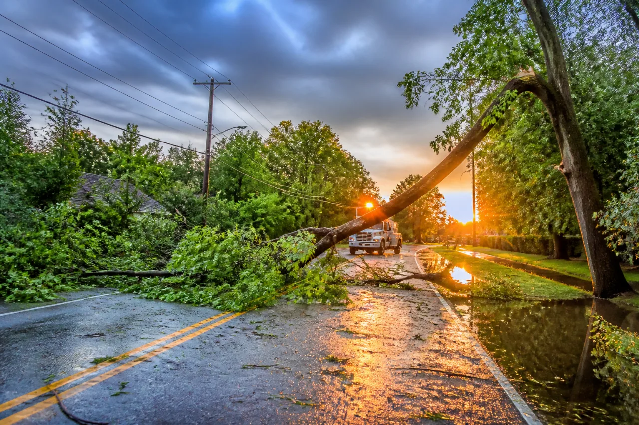
A strong thunderstorm that moved through parts of the Northeast Kingdom and central Vermont Thursday evening snapped tree limbs in Burke, knocked out power for some customers and produced minor street flooding in Barre, local media and residents reported.
Photographs from Darling Hill Road in Burke show several broken limbs and scattered debris after the storm moved through the area shortly after 6 p.m. on Thursday, according to NBC5.
What residents saw and felt
Neighbors in the Burke area described gusty winds that toppled branches and left limbs across road shoulders. Tim Simpson submitted photos to NBC5 showing downed limbs on Darling Hill Road. Utility companies reported outages in portions of central Vermont and the Northeast Kingdom; crews were dispatched to assess damage and restore service.
- Location: Darling Hill Road, Burke; additional reports across the Northeast Kingdom and central Vermont.
- Time: Storm moved through shortly after 6 p.m. Thursday.
- Impacts: Downed tree limbs, localized power outages, minor street flooding in Barre.
Weather context and short-term forecast
Forecasters warned that scattered showers and embedded thunderstorms were possible into the evening and overnight, raising the risk for localized heavy rain where storms redeveloped or trained over the same areas. Meteorological guidance issued early Thursday noted a modest increase in expected rainfall amounts near the international border and along Vermont’s central Green Mountains, along with a higher chance of showers and storms early next week as temperatures trend upward.
| Key message | Implication for residents |
|---|---|
| Scattered showers with embedded thunderstorms | Possible localized heavy rain and gusty winds — watch for downed limbs and reduced visibility. |
| Increasing shower and thunderstorm chances early next week | Plan for unsettled weather and monitor forecasts if you have outdoor plans. |
Practical information for Vermonters
Officials advise motorists to slow down in standing water and avoid driving through flooded sections of roadway. If you encounter downed power lines, treat them as live and keep a safe distance; report outages to your utility provider. Residents with damage confined to limbs and small debris should clear sidewalks where safe and coordinate larger limb removal with local highway crews or professional arborists.
Local emergency management and utility companies typically post restoration updates on their websites and social media feeds; residents should check those channels for the latest information on outages and road conditions. NBC5 updated its report Thursday night, and images and local reports continue to provide a picture of the storm’s localized impacts.
While the most severe effects of the storm appear limited to scattered tree damage and minor flooding, the evening’s storm underscores the need for vigilance during a period of repeated showers and thunderstorms in the region.
Reporting from the Northeast Kingdom.
















