
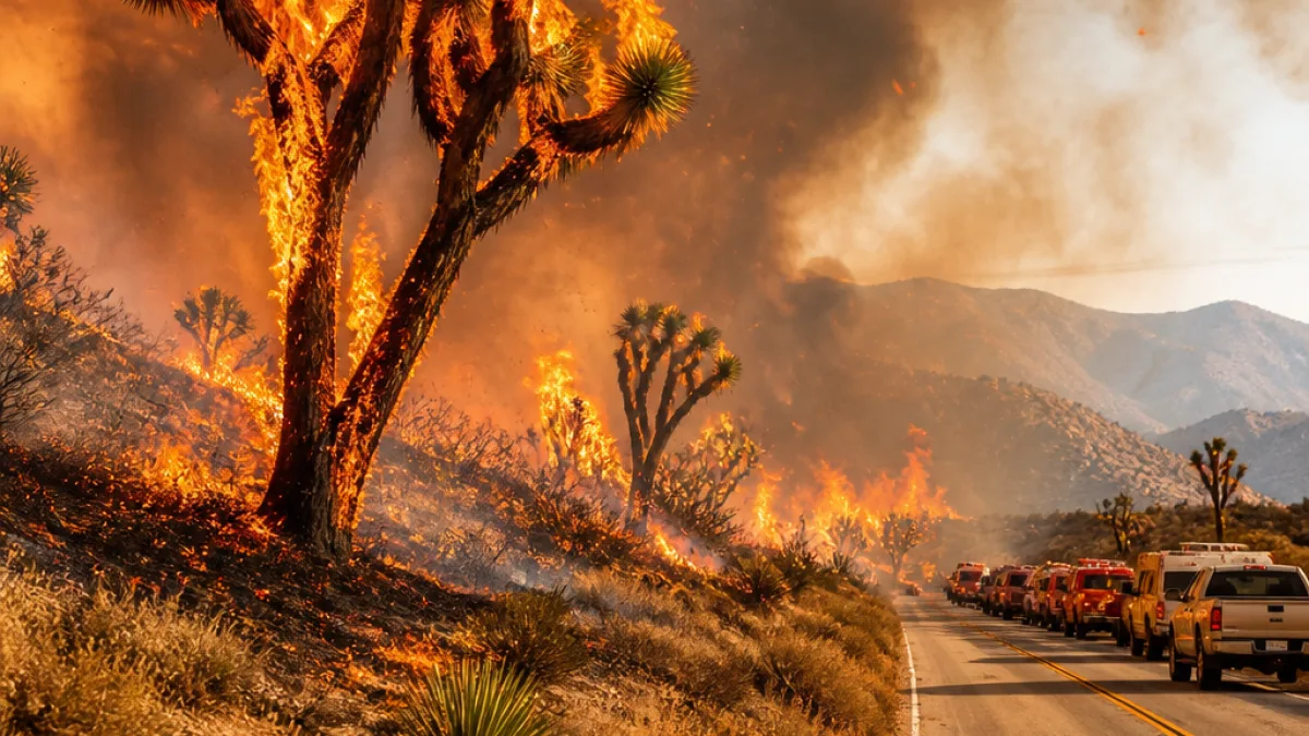
What residents need to know: A wildfire dubbed the Summit Fire erupted in the Antelope Valley on Friday afternoon and moved quickly through desert slopes toward the San Gabriel Mountains, prompting mandatory and advisory evacuations and visible damage to Joshua tree habitat.
Where the fire is and how fast it spread
The blaze began before 1:30 p.m. in the unincorporated community of Llano, between Victorville and Palmdale. By 4 p.m. the fire had burned roughly 1,600 acres, and later reports from fire agencies indicated growth into the low thousands of acres as crews continued to respond.
Flames advanced rapidly to the south, pushed by gusts up to 25 mph, daytime temperatures near 100 degrees and relative humidity falling as low as 10%. Steep terrain funneled the fire from desert slopes up into foothill areas of the San Gabriel Mountains.
Evacuations and local impact
Authorities issued mandatory evacuation orders stretching from Highway 128 north to Big Pines Highway to the south, an area that includes access roads near the Mountain High ski resort. Evacuation warnings covered additional nearby zones as agencies moved to protect residents and recreation sites.
- Initial report came from the area of Jesus Canyon Road and East Avenue Z in Llano.
- Angeles National Forest and local fire departments are assisting in suppression efforts.
- Containment remained limited early in the incident as crews focused on evacuations and structure protection.
Environmental concerns: Joshua trees in the burn area
Photographs released by Cal Fire showed flames consuming desert vegetation that included plants appearing to be Joshua trees. The Joshua tree is native to the Mojave and its range extends into northern Los Angeles County, according to California Department of Fish and Wildlife mapping and the National Park Service.
| Known conditions | Reported detail |
|---|---|
| Start time | Before 1:30 p.m. |
| Location | Llano, Antelope Valley (near Avenue Z and 248th Street) |
| Wind gusts | Up to 25 mph |
| Temperature | About 100°F |
| Relative humidity | As low as 10% |
| Acres reported burned (afternoon) | About 1,600 acres (later estimates higher) |
Joshua trees are the subject of a 2023 California law that generally prohibits the import, export, take, possession or sale of western Joshua trees without authorization from the state. Wildfires that burn through these stands raise concerns among land managers and conservationists about long-term habitat loss.
Mountain High narrowly avoided severe damage in 2024 during the Bridge Fire, which later burned through tens of thousands of acres in the Angeles National Forest. Some terrain burned in that earlier fire remains charred; if the Summit Fire reaches those areas, fire behavior could change where fuels are already reduced.
Residents in the evacuation zones should follow instructions issued by Los Angeles County fire authorities and check Cal Fire and county emergency pages for the latest advisories, road closures and shelter information. News Block will update this report as fire officials provide new details.
Reporting from northern Los Angeles County.
















