
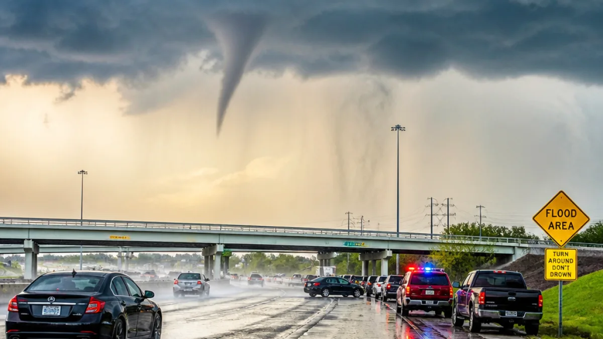
Heavy, slow-moving storms drenched large parts of South Texas this week, producing a reported tornado in northwest San Antonio and prompting warnings for potentially dangerous flash flooding that could affect the city and surrounding counties.
Storm produced brief twister near I-10; no immediate injuries reported
The National Weather Service reported that a tornado touched down near Interstate 10 in the northwestern portion of San Antonio. Social media videos showed what appeared to be a small twister. There were no immediate reports of injuries, according to official updates.
“This is called a typical mid-summer tropical weather pattern that happens in Texas,” Monte Oaks, a meteorologist with the National Weather Service, said, noting that the storms are being fueled by tropical moisture from the Gulf of Mexico and some moisture from the Pacific.
Meteorologists warned the deluge could persist through Thursday evening, leaving some areas at risk for substantial rainfall accumulations. The Weather Service estimated that 10 to 20 inches of rain were possible in some locations before the system moves out. Uvalde County had recorded the highest totals so far, with patches measuring up to 16 inches.
Watches, warnings and state response
Flash flood warnings were posted for multiple counties in South Texas, including those near the Mexico border and areas west of San Antonio. State officials issued disaster declarations for dozens of counties in response to the widespread heavy rain and flooding threat.
- Immediate risks: flash flooding on roads, farmland, and low-lying areas; high-water rescues.
- Geographic focus: west of San Antonio and north of Route 90 identified as areas of highest flood concern.
- Rain totals so far: up to 16 inches reported in parts of Uvalde County.
Local emergency managers in counties with high river risk, including Kerr County, said they were contacting summer camps and retreat centers along rivers and streams. That outreach reflects heightened concern after catastrophic flooding along the Guadalupe River last year that killed more than 100 people in Kerr County.
| Item | Detail |
|---|---|
| Possible rainfall | 10–20 inches in some areas |
| Highest reported | 16 inches in Uvalde County |
| Tornado report | Northwest San Antonio, near I‑10; no immediate injuries |
What this means for San Antonio and Bexar County
For San Antonio residents, the combination of heavy rain and a brief tornado report underscores multiple hazards: localized wind damage, fallen trees and power lines, and rapid urban and river flooding. Urban flooding can trap vehicles and cut access to critical routes such as Interstate 10. For Bexar County and neighboring counties, prolonged heavy rains raise the prospect of repeated high-water rescues and strain on local emergency services.
State and local officials will be monitoring stream and river gauges closely. The scale of the event — driven by a slow-moving, moisture-rich weather pattern — means some communities could see repeated rounds of heavy rain over consecutive days, increasing cumulative flood risk even where initial rainfall is modest.
Residents should heed warnings from the National Weather Service and local emergency management: avoid flooded roadways, move to higher ground if water rises, and stay tuned to official channels for watches or evacuation guidance.
As the system moves through South Texas, authorities emphasized preparedness and vigilance, particularly in areas with a recent history of catastrophic flooding.















